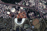
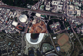
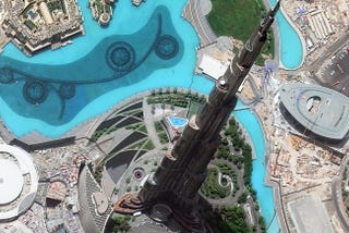
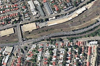
PinnedArlulaSatellite imagery helps identify potential billion dollar construction oversight.Due to the scale of the tunnelling, the only practical way to accurately measure the impact is through satellite imagery.4 min read·Sep 7, 2021----
ArlulaGeospatial data start-ups join forces to change the EO industry.On February 24th Ellipsis Drive and Arlula announced a partnership that will empower a new generation of Space based Earth Observation (New…3 min read·Feb 24, 2022----
ArlulaAustralian space tech companies team up to deliver industry first on-demand satellite imaging…Over the course of several decades, satellite imagery has emerged as one of the most critical tools for monitoring the Earth’s land, oceans…3 min read·Jan 24, 2022----
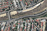
ArlulaSpace technology as a tool for architecture and construction projects!In recent decades urban development, town planning, architecture, and construction have dramatically increased. Until recently, this…4 min read·Oct 26, 2021----
ArlulaAgtuary joins farmers and banks with space technologies!Agriculture is one of the world’s oldest and most important industries, and it’s the key to feeding the future of the world’s population…4 min read·Jul 29, 2021----
ArlulaSatellite Imagery Powering the Autonomous Vehicle RevolutionSatellite imagery and HD mapping prepares the ground for full automation5 min read·Mar 5, 2021----
ArlulaArlula Satellite Imagery API UpgradesHappy Holidays and Welcome to API version 2020–124 min read·Dec 23, 2020----
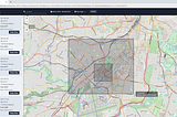
ArlulaStream Sample Satellite Imagery with the Arlula APILearn how to access free high-res satellite imagery from our growing sample library with the Arlula API and dashboard4 min read·Aug 26, 2020----
ArlulaArlula Satellite Imagery API: Beginners GuideLearn how to stream satellite imagery with the Arlula API8 min read·Aug 14, 2020--1--1