Space technology as a tool for architecture and construction projects!
In recent decades urban development, town planning, architecture, and construction have dramatically increased. Until recently, this increase has been attributed to hardware advancements, such as trucks and tools. However, one of the fastest-growing tools used on modern construction sites is aerial imagery. Current methods of obtaining aerial imagery, such as drone flights, can be costly and time-consuming. The satellite imaging industry has recently undergone a shift, and high-quality satellite imagery from space is becoming increasingly affordable. How exactly can satellite imagery be integrated into construction sites and the architectural design process?
The demand for drones has been increasing over the past decade and there are many advantages when it comes to applying them to the construction industry. Large-scale construction projects will have project managers map out the construction site every week, which can be an incredibly timely process. Mapping is essential for real-time tracking of building development, machines and large tools, and safety inspections. Many large-scale architecture projects, such as the Apple Park (see below) were constructed over multiple years and required a lot of imagery. Mapping this information with aerial imagery also allows building managers to get a birds-eye view of the entire project, which can reveal information that would be impossible to see from the ground level.

Satellite imagery also allows for the archiving and storage of images, so a construction team would be able to go back weeks, months, or years to retrace events. Therefore, it would be possible to map the impact of flooding or high winds on a construction site all from a safe distance. In addition to this, satellite imagery could assist with the surveillance of site assets. Around $650 million dollars worth of construction equipment is stolen each year from construction sites around Australia, satellite imagery could provide evidence and assistance with asset monitoring.
Not only can satellite imagery assist with monitoring construction, but it can also be used to monitor safety concerns and track large machinery around the site. There is also potential for calculating stockpile and inventory levels with satellite imagery. Satellites can take a photo of a location around once a week and with advancements in technology, imagery could be available more often and data could be instantly shared within a construction team.
Satellite imagery also has the ability to enhance the design process. During the design process, it is important to consider how a building will fit in with its wider context. Many architects will deliberately design a building that contrasts its surroundings, however, most buildings will be designed to fit.
Up-to-date satellite imagery will provide architects with images that can inform essential design decisions such as contrast, unity, composition, scale that make up the character of the building. The ideal character of a building will exhibit mutually beneficial interactions with the surrounding environment.

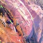
Satellite imagery is becoming increasingly affordable and accessible. Companies like Arlula are making satellite imagery more accessible and affordable. You can now easily browse historical and up-to-date satellite imagery of large construction projects with the Arlula catalog browser.
Satellite imagery also allows for the archiving and storage of imagery, so a construction team would be able to go back weeks, months, or years to retrace events. Therefore, it would be possible to map the impact of flooding or high winds on a construction site all from a safe distance. In addition to this, satellite imagery could assist with the surveillance of site assets. Around 650 million dollars worth of construction equipment is stolen each year from construction sites around Australia, satellite imagery could provide evidence and assistance with asset monitoring.
Not only can satellite imagery assist with monitoring construction, but it can also be used to monitor safety concerns and track large machinery around the site. There is also potential for calculating stockpile and inventory levels with satellite imagery. Satellites can take a photo of a location around once a week and with advancement in technology, imagery could be available more often and data could be instantly shared within a construction team.

Track your favourite buildings from space today with the Arlula catalog browser at https://api.arlula.com/catalog !